Clopper Lake
September 14
Sunday
 Due to some potential issues with newly detected invasive plants at Lake Needwood, we'll be holding this event instead in the Clopper Lake section of Seneca Creek State Park in Gaithersburg, MD, on a new map courtesy of mapper extraordinaire, Nadim Ahmed. We hope to fit in an event at Lake Needwood later in the season.
As with all QOC events, we will have free newcomer instruction at this event. A QOC member will show you how to read a map, teach you how to use a compass with your map and give you hints on how to navigate your choice of course. Besides that, just wear a smile and the clothes you would for a hike or run in a local park. Bring a compass, if you have one, or borrow one at the event. And dogs (on leash) are welcome at Seneca Park too. Driving directions are below.
Update: Although not printed on the maps, the contour interval is 5m (for all maps). Map scales are 1:5000 for beginner (white and yellow) courses and 1:10000 for all others; for other course details, see the stats below, as well as the quite detailed map and course setter notes. Event timing will be standard: register anytime between 10:45 - 1:15, start between 11 - 1:30, and be back before the controls start being picked up at 3pm.
Any youth or large groups attending, please contact the Event Director so that we can coordinate pre-registration for your group; the group registration and waiver form is part of the information on our Group Leaders page.

| Location | Seneca Creek State Park, Clopper Lake, Buck Pavilion, Gaithersburg, Maryland (Classic) | ||||||||||||||||||||||||||||||||
| Registration | No advance registration required. Just show up and have fun! | ||||||||||||||||||||||||||||||||
| Start Times | You may start your course at any time during the start window listed below for your event. | ||||||||||||||||||||||||||||||||
| Schedule | Sunday, September 14
| ||||||||||||||||||||||||||||||||
| Volunteers |
| ||||||||||||||||||||||||||||||||
| Location Details |
| ||||||||||||||||||||||||||||||||
| Course Details | Classic
| ||||||||||||||||||||||||||||||||
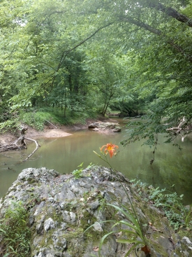
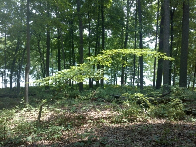
| Course Notes | Classic Map & Terrain Notes The Clopper Lake area of Seneca Creek State Park being used for the event was mapped May through August 2014, when a lot of the ground cover was already out and when many of the trees were already lush. The area has a lot of similarities with the McKeldin area of Patapsco State Park, but with some significant differences. Like at McKeldin, there are a lot of roads and parking lots for picnic areas. This tends to make a lot of the navigation easier. Being situated in the midst of much suburban development, a lot of people use the picnic areas. Racers need to be aware that they are sharing the park and need to show the usual courtesies so that we can keep returning year after year. Also like at McKeldin, significant areas of open or rough open ground exist in the park. Both parks have a large, mostly un-crossable stream that runs along the map edge, and areas of rock detail. The rocks can be quite pleasant to navigate at Clopper Lake as they are a little more plentiful than other similar parks in Montgomery County, MD. The rocks range from 2-3 meter cliffs, large & small boulders, and stony ground. An obvious difference between the McKeldin and Clopper Lake areas is that a 1.5 mile long lake dominates the mapped Clopper Lake area. There’s also a large power line ride across the north end of the map at Clopper Lake. The slopes around Clopper Lake are generally less steep with fewer reentrants too. Vegetation in the Clopper Lake area tends to vary considerably. It can be thick on south facing slopes and wide open on north facing slopes. Pine and deciduous vegetation boundaries can be very distinct. Those not familiar with standard vegetation mapping symbology will benefit by doing some review in advance. Besides different shades of green indicating running speeds in the forest, there are different kinds of low, scattered tree, and open vegetation symbols. All of these are present in the park. Additionally, given that it’s still summer, not all of the low vegetation is mapped. The reason for not mapping it is that much of it will disappear in the colder months. Invasive stilt grass (generally unmapped since it disappears) has grown significantly in the last month alone and that makes it hard to see the occasional fallen branches or sticks on the ground—it’ll slow you down in several areas that are mapped white as fast-run forest. Areas mapped in medium or dark green should be avoided at this time of the year as they will slow you down even more. Though much of the park and green mapped areas are not thorny, there are a few areas with thorny ground cover. Rough open ground should generally be avoided at this time of year due to tall grasses (some of this is unavoidable such as in the power line rides). A creeping vine plant with triangular leaves can also be found in the rough-open and scattered-tree-rough-open terrain. It does have small hooked thorns that will stick to clothes making it more annoying than hurtful—wear good gaiters. Some of the larger areas mapped with the low vegetation symbol are a kind of deciduous, non-thorny creeper that forms loops. These loops will sometimes catch your feet when you run or when you don’t lift your knees high enough. As with other parks, some use of the low vegetation symbol represents dead fallen branches and others indicate small bushes. A unique area of the map is the large peony field on the north side of the lake. The large peony plant flowers bloom there in the springtime but the area looks like tall grass the rest of the year—the plants were cultivated by a former land owner. A rectangular lattice of trails, not enough for a maze, is kept mowed in the peony field and will be the fastest way to get through it if your course route crosses it. Mapped root stocks tend to be 2m tall or more, except in isolated cases of open forest where they may be smaller. Thanks go out to Greg Lennon who acquired the base map data. Course Notes An area on the map marked with the danger symbol (purple X’s) may be encountered by Green/Red/Blue runners who stray off-course when on legs 12 and 13 for Blue or Green courses, and legs 11 and 12 for the Red course. The danger is from old broken glass bottles and some other old junk scattered on the ground. It is possible that glass exists on the ground beyond what has been mapped. If finding yourself in it, walk carefully. Mapped ruins are generally just old foundations. Some of these might be a few corner blocks of concrete that wooden structures long gone, had sat upon. The White course is fairly straightforward with parts along the lake shoreline. There are some slower intermittent trails, parallel to the maintained trails. While passing near other pavilion shelters, participants should take care not to disturb other park users. There are some park road crossings. Though there are good handrails (mostly trails), the Yellow course could be challenging for some. It favors those still novice runners who are skilled enough to cut through short stretches of forest off-trail. This is consistent with Orienteering USA guidelines for Yellow level courses. There are some park road crossings and route choices along roads. There’s not much unusual about the Orange or Brown courses. There are a few point feature controls for the Orange course, but these are generally along a strong contour handrail such a stream or where a hill ends distinctly at a valley floor. With beaver activity, even small streams in a chosen route may have some deep water sections that are harder to cross. Due to compressed mapping schedules, there is one area at the east-northeast end of the lake that Green/Red/Blue courses past through where field checking was not completed. Using the mapped trail through this will be the most efficient route. I hope you can enjoy the park as much as I’ve had exploring and mapping it! I hope to expand the mapping to other adjacent parts of Seneca Creek State Park in the future and know that these will add even more variety and be fun to navigate through. Nadim Ahmed | ||||||||||||||||||||||||||||||||
| Entry Fees | Individual Entries
Note: juniors = under 21
Team or Group Entries Participants are welcome to compete together as a single team entry. Teams containing one or more nonmembers are charged the nonmember individual rate. Teams containing one or more adults are charged the adult individual rate. For teams to receive member or junior rates, all members of the team must be members or juniors, respectively. Each extra team map beyond the first is an additional $2. Individuals or teams desiring to compete on a second course can do so for a reduced fee of $2/map. Important Notes
|
