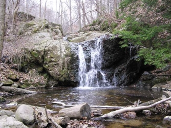
Patapsco Glen Artney
February 23
Sunday
 Welcome to the only second event in recent times in the Glen Artney area of the Patapsco Valley State Park system. Course setter Ted Good has designed a full set of courses (and detailed course and map notes are now posted below), applicable to all skill levels, which we hope you will come out and enjoy.
Patapsco Valley State Park has a strict rain policy, which will force us to postpone or cancel the event in case of more than 1/4” of rain within the 24 hours preceding the event. Please check this web site for any information of cancellation before traveling to the meet if rain has been falling. Update as of Sat. 2/22: No rain means this event is on!
Parking and registration will be in the commuter parking lot at the intersection of S. Rolling Road and Rte. 166. Port-a-potties can be found at the registration site.
Safety Notes: 1.) The parking lot itself is an active traffic area, occasionally used by tour busses to pick up and drop of passengers. 2.) The start and finish for the courses will be in the park itself, across from the parking lot. To get to the start and to return to the registration/download desk you will need to cross S. Rolling Road. The road carries regular traffic traveling at speeds of 40 mph or above. Please exercise great CAUTION when crossing the road. PARENTS & COACHES: please keep children under close supervision. You are responsible for your own and your group’s safety.
- Event registration will be from 10:45am - 1:15pm; start your course anytime between 11am - 1:30pm, and be back no later than 3pm.
- Two port-a-potties will be available at the parking/registration area.
- Dogs are welcome but must be on a leash at all times.
- Epunching will be used on all courses.
Michael Kholodov is designing and setting the ARDF course using his own equipment. He will have a number of receivers available for use at this event on a first-come, first-served basis. There is a separate fee of $10 for the use of a receiver.
You can run the ARDF course before or after (or instead of) your regular course. The start window is the same (start between 11 and 1:30, off the course by 3). If you are interested in trying ARDF, please let Michael know via email to michkhol@yahoo.com, with the approximate time you think you'll be able to start.
Group Leaders: please see our For Group Leaders webpage and then contact the Event Director so your group can get pre-registered in advance.
Feel free to use our Contact Us form if you have any questions!
| Location | Patapsco Valley State Park, Glen Artney, Catonsville, MD (Classic) | ||||||||||||||||||||||||||||||||
| Registration | No advance registration required (other than for large groups). Just show up and have fun! | ||||||||||||||||||||||||||||||||
| Start Times | Start any time between the specified times (usually 11am - 1:30pm). | ||||||||||||||||||||||||||||||||
| Schedule | Sunday, February 23
| ||||||||||||||||||||||||||||||||
| Volunteers |
| ||||||||||||||||||||||||||||||||
| Location Details |
| ||||||||||||||||||||||||||||||||
| Course Details | Classic
| ||||||||||||||||||||||||||||||||
| Course Notes | Classic
It has been 7-8 years since we last used this area. At that time, they stopped mowing the grass and planted trees. As you can guess, the vegetation has changed much since then. Over the years, some of planted trees died and some are now 8 years old. The northern part of the map is very fast with open fields and scattered trees. It was a very subjective call on what is mapped as rough open scattered trees and what is forest made up with small trees. The southern part of the map is very fast with open deciduous forest. The middle part is the problem area with thorny green. There is major green in this some areas and the green is thorny. Do not ignore the green thinking you can get through. You will want to USE the TRAILS THROUGH the GREEN whenever possible. Note: Normally, impassable areas are mapped as fight/dark green even if they occur in fields, but I used double vertical slashes instead of fight so the fields can still be seen on the map. For a detailed explanation of how I have mapped the green, click here . There are large number of trails on this map with new ones continually being built. You may see streamers for future trails in the woods. There are some active box bee hives on this map. They are just off the trails but please don’t disturb them. I have put some purple areas on the map around them to note the are out of bounds. Mapped root stocks are approximately 2 meters tall or larger. Most rock on this map is small. Trails in this park are heavily used by bikers and hikers. Be alert. Advanced Courses:
| ||||||||||||||||||||||||||||||||
| Entry Fees | Individual Entries
Note: juniors = under 21
Team or Group Entries Participants are welcome to compete together as a single team entry. Teams containing one or more nonmembers are charged the nonmember individual rate. Teams containing one or more adults are charged the adult individual rate. For teams to receive member or junior rates, all members of the team must be members or juniors, respectively. Each extra team map beyond the first is an additional $2. Individuals or teams desiring to compete on a second course can do so for a reduced fee of $2/map. Important Notes
|
