Mason Neck
January 28
Sunday
 Pre-registration is required for this event, opening Monday, Jan. 22 at 6pm and closing Saturday Jan. 27 at 12 noon.
There will be no day-of registration.
Get ready for another fast-running, mid-winter event at club favorite, Mason Neck State Park!
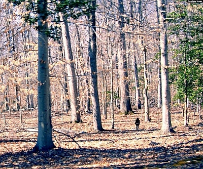
Orienteering at Mason Neck provides a distinctive navigation experience due to the flatness of this coastal plain terrain. The park's subtle contours (2.5 meter contour interval rather than the standard 5 meters) and subtle features present a change from the usual Northern Virginia spur and reentrant terrain. At Mason Neck you'll enjoy the chance to develop your compass skills and pace counting. Runners have their choice of a full set of classic courses (details below) thanks to Will Hubsch who has set courses for LAOC in the past, and now, having come east, has volunteered to be a course setter for QOC. In addition, the map has improved thanks to QOC's Mark Thomsen, who has made selected updates to the map following last year's event.
Also, to help those new to the very useful skill of pace-counting, we will set up a 100 meter pace course. Those interested will be able to get some instruction/recommendations on how to calculate your pace and employ pace-counting most effectively.
Check in will be on the west side of the main parking area as usual. Follow QOC signage from the turn off of Gunston Road.
![]()
Volunteer SignUps: If you'd like to help at this event, click here or contact the Event Director.
Post-Event Social: After your run, join fellow orienteers at Hometown Grill and Bar for a bite to eat. Show your map and get a treat with purchase, courtesy of Chef Scott Perry! Hometown Bar and Grill is located here, just 9.2 miles north of Mason Neck.
Keep in mind:
- There is a park entry fee of $10 per vehicle that is collected at the park gate.
- The rest rooms at Mason Neck are adjacent to the check in area and will be open for our event.
- All participants must pre-register; there is no day-of registration.
- The size of start teams (groups of individuals orienteering together with one e-punch) on a course must be no more than four (4) individuals (juniors and adults combined).
- No food items will be provided.
- Participants are responsible for meeting all their own hydration needs before, during and after their courses.
- As always, please be off the course no later than 3pm and remember to download at our e-punch station even if you did not finish.
- Beginner's instruction will be available.
- For those new to orienteering, make sure to check out our Your First Event and Orienteering Techniques For Beginners webpages, and if they don't answer any question you have, just use our Contact Form and ask.
- Group Leaders (of larger groups): please contact the Event Director so they are aware of your plans.
- Dogs are allowed in the park but must be on a leash of no more than six feet at all times.
| Location | Mason Neck SP, Mason Neck SP, Lorton, VA (Classic) | ||||||||||||||||||||||||||||||||
| Registration | Registration for this event opens at 6pm on Monday Jan. 22 via this link. Registration will close at 12 noon on Saturday Jan. 27 (the day before the event). Pre-registration is mandatory.
Who's Registered? Check by clicking here. | ||||||||||||||||||||||||||||||||
| Start Times | Start times will be by windows (to be defined for this event before registration opens). | ||||||||||||||||||||||||||||||||
| Schedule | Sunday, January 28
| ||||||||||||||||||||||||||||||||
| Volunteers |
| ||||||||||||||||||||||||||||||||
| Location Details |
| ||||||||||||||||||||||||||||||||
| Course Details | Classic
| ||||||||||||||||||||||||||||||||
| Course Notes | Classic The terrain at Mason Neck is very flat, open, and will present a challenge staying in contact with the map. Some courses run on the longer side distance-wise, but the good runability, great visibility, and limited climb should make running times fairly standard. Controls are reasonably far apart from each other, but please check your codes when punching. The Blue course is unique in that it has two separate loops, where runners will visit a control twice. Many controls belong to several courses, with runners entering and exiting from different angles, so hopefully you'll see a lot of folks out there running every which way. The contour interval is 2.5 meters. I've tried to set courses that thread the needle between interesting and fair, given the lack of features, and have leaned towards having quite a few controls to keep things exciting. The key here will be knowing when you need to know your exact location and when you can just run to a catching feature. If you use pace counting, this might be the map to put it to the test. As with many maps, not all rootstocks are mapped, and conversely, some mapped rootstocks are no longer as obvious as they once were, so keep that in mind. The visibility of marshes and watercourses fluctuates quite a bit based on recent rainfall, and it looks like rain is in the forecast for the week leading up to the event. Keep in mind that the open marshes along Kanes Creek on the north edge of the map may be totally impassable if there's been recent or significant precipitation. All courses will cross High Point Road (the paved road you came in on) at least once; please use caution when crossing it. All courses will start at the turnaround circle 50 meters northwest of the registration/download area. | ||||||||||||||||||||||||||||||||
| Entry Fees | Individual Entries
Note: juniors = under 21
Group Entries Participants are welcome to orienteer together as a group (up to the maximum for that event; usually 4). Each member of a group is charged their individual rate as shown above, up to a group total of $30 (maximum), and each receives a map. A group receives one epunch. Individuals or groups desiring to compete on a second course after completing their first can do so for a reduced fee of $2/map subject to approval at the event by the Event Director. Important Notes
|