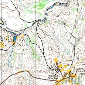
Prince William Forest Park
| Location | Directions |
|---|---|
| Williams Ballfield Google Map | Prince William Forest Park is located at I-95 Exit 150B (Joplin Rd - Rt 619 West). Stay right as you exit I-95 and as you travel westbound on Joplin Road the park entrance is your second right. Parking will be on Williams Ballfield (follow signs towards the Visitor Center); stay to the right on the park road until you see parking volunteers who will guide you to the field. |
| Oak Ridge Campground Google Map | Take I-95 to exit 150 (150B from points north). Head west on Joplin Road (VA-619) and take the second right for the park entrance. Turn left 0.5 miles from the park entrance, onto Scenic Drive. Bear left at the split in the drive to stay on Scenic Dr (signs toward Turkey Run Education Center), continue for 3.6 miles, then turn left on West Gate Fire Rd to the Oak Ridge Campground. (Scenic Drive becomes one-way at that point, and you MUST turn left anyway.) Allow at least 20 minutes drive time inside the park. Warning: do not use nav software that incorrectly suggests taking Mawavi Rd from Rt 619/Joplin Rd, or, taking Old Blacktop Road from Turkey Run Ridge Camping Area. Both are closed to through traffic. Google Maps Link Apple/iPhone Link |
| Pine Grove Google Map | Take I-95 to exit 150 (150B from points north). Head west on Joplin Road (VA-619) and take the second right for the park entrance. The Pine Grove pavilion is on the left just before the Visitor Center. Google Maps Link Apple/iPhone Link |
| Camp 5 - Happyland Google Map | From I-95 exit 150B (near Triangle, VA) go west on Joplin Road ~4.5 miles, then turn right and follow the red and white orienteering signs on Mawavi Road. Registration is (usually) in the Dining Hall of Camp 5. More detailed directions available using the Google map link. Note: Mawavi Road is likely to have runners on it - please be careful as you drive in. Please park in lots or where directed by volunteers (otherwise you're likely to get a costly ticket). Google Maps Link Apple/iPhone Link |
| Telegraph Rd Parking Area Google Map | Take I-95 to exit 150 (150B from points north). Head west on Joplin Road (VA-619) and take the second right for the park entrance. Follow signs towards the Visitor Center, then head just east of the Visitor Center to the parking area. |
| Camp 3 - Orenda Google Map | Cabin Camp 3 is located just off of the park's Scenic Drive, approximately 1 mile from the entrance station. After entering the park, take the first left onto Scenic Drive. Take a right onto Orenda Road. |
| Turkey Run Google Map | Take I-95 to exit 150 (150B from points north). Head west on Joplin Road (VA-619) and take the second right for the park entrance. Turn left 0.5 miles from the park entrance, onto Scenic Drive. Bear left at the split in the drive following signs for the Turkey Run Education Center, then turn right at the sign shortly after the split for the Turkey Run Education Center & Campground. Driving time inside the park is ~15 minutes. Google Maps Link Apple/iPhone Link |
| Camp 2 - Happyland Google Map | From I-95 exit 150B (near Triangle, VA) go west on Joplin Road ~4.5 miles, then turn right and follow the red and white orienteering signs on Mawavi Road. More detailed directions available using the Google map link. Please park where directed by volunteers (otherwise you may get a costly ticket). Google Maps Link Apple/iPhone Link |

