Hemlock Overlook
May 18
Sunday
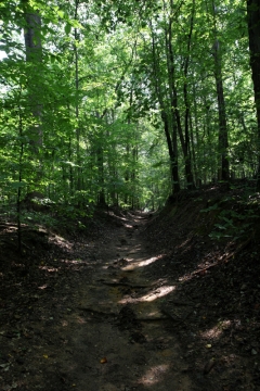
 Welcome back to Hemlock Overlook Regional Park, on the banks of the Occoquan. We'll have a full set of courses, from beginner to advanced, at this penultimate event of the season. This event will also feature a new version of the Hemlock map, field checked this winter and spring starting from a new LiDAR-derived contour basemap.
Event timing will be standard: register anytime between 10:45 - 1:15, start between 11 - 1:30, and be back before the controls start being picked up at 3pm. Course and map details are below. Dogs on leash are welcome at this park.
Any youth or large groups attending this event should contact the Event Director so that we can coordinate pre-registration for your group; the group registration and waiver form is part of the information on our Group Leaders page.
| Location | Hemlock Overlook Regional Park, Hemlock Pavilion, Clifton, VA (Classic Orienteering) | ||||||||||||||||||||||||||||||||
| Registration | No advance registration required. Just show up and have fun! | ||||||||||||||||||||||||||||||||
| Start Times | Start your course at any time between 11 - 1:30 (and be done no later than 3pm). | ||||||||||||||||||||||||||||||||
| Schedule | Sunday, May 18
| ||||||||||||||||||||||||||||||||
| Volunteers |
| ||||||||||||||||||||||||||||||||
| Location Details |
| ||||||||||||||||||||||||||||||||
| Course Details | Classic Orienteering
| ||||||||||||||||||||||||||||||||
| Course Notes | Classic Orienteering Some fine runnable woods are waiting for you this Sunday at Hemlock Overlook Regional Park, although with the leaves out you can't see quite as far through the woods as you may have become accustomed to over the winter, kicking the difficulty up a notch. Since we'll be doing middle distance courses in this park during our November A meet, most of the intermediate and advanced courses for this event strongly emphasize route choice ("most" since the emphasis is less strong though not entirely absent on the Brown course) - consider it training for the Ultra Long Championships we'll be holding at Fountainhead as part of that same November A meet (it is highly recommended that intermediate and advanced runners refrain from looking at the map, more than is necessary to make sure you got the right course colour, until you've punched the start, in order to get the full challenge of making route choices under time pressure). The map is most of but not all the way to where it will be come November. The new LiDAR-derived contours are excellent throughout the park but look a bit strange in places since they still incorporate some random noise and artifacts from the LiDAR data - this will be smoothed out over the coming months as the software-generated contours are manually redrawn to remove the noise and let the signal shine through in the places where it's currently slightly obscured. Middle distance courses in November won't require the entire park so to date there has been thorough field checking only of the more pleasant 2/3 of the park. The remaining 1/3 either won't be used (on Sunday or in November) or has been more cursorily updated to show new trails, more significant changes to vegetation and other prominent features. Translated into practical terms, expect the map to be quite good south of the start/finish and good enough north of the start/finish, with the difference mostly lying in just how well areas of thicker vegetation and deadfall in the north are mapped (generally somewhat undermapped). By design, only the white and blue courses go very far north of the start/finish. Participants on both white and blue should have no trouble ignoring the shortfalls in the vegetation mapping and navigating by the contours and mapped beginner-friendly features such as trails, fields, buildings, watercourses, etc. White will be printed at a scale of 1:5,000, yellow at 1:7,500 and all other courses at 1:10,000. The contour interval on all maps will be 5 meters.
| ||||||||||||||||||||||||||||||||
| Entry Fees | Individual Entries
Note: juniors = under 21
Team or Group Entries Participants are welcome to compete together as a single team entry. Teams containing one or more nonmembers are charged the nonmember individual rate. Teams containing one or more adults are charged the adult individual rate. For teams to receive member or junior rates, all members of the team must be members or juniors, respectively. Each extra team map beyond the first is an additional $2. Individuals or teams desiring to compete on a second course can do so for a reduced fee of $2/map. Important Notes
|

